Portuguese Camino Coastal Route: stages, distances and what it is like
The Portuguese Coastal Route leaves Porto and follows the Atlantic coast northwards: Matosinhos, Vila do Conde, Póvoa de Varzim, Esposende, Viana do Castelo and Caminha. There you cross the Minho by boat to A Guarda and the route continues along the Galician coast, via Oia, Baiona and Vigo, until it joins the Central Route at Redondela.
Adding up the usual stages it is about 271 km (168.3 miles) to Santiago, split into 13 stages: 9 of its own, from Porto to Redondela, and the 4 it shares with the Portuguese Camino Central Route from Redondela to Santiago. For anyone with a week, the shortest start that qualifies for the Compostela is Vigo: you will find it in the Camino de Santiago from Vigo.
The 13 stages of the Portuguese Camino Coastal Route, from Porto to Santiago de Compostela
Stage 1: Porto – Labruge (24.5 km (15.2 mi))
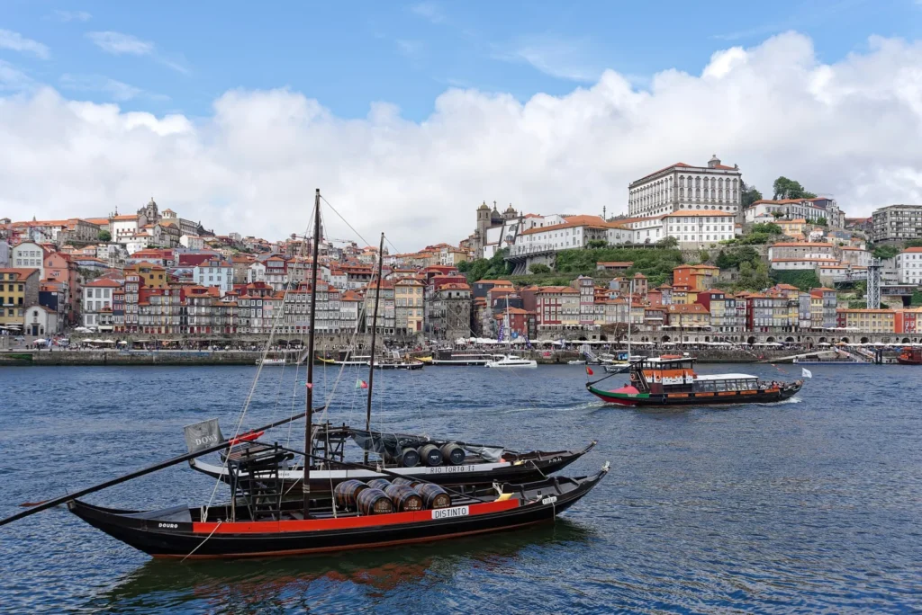
Stage 1: Porto – Labruge (24.5 km (15.2 mi))
You descend to the mouth of the Douro at Foz do Douro and follow the Atlantic coast through Matosinhos and Leça da Palmeira. There is an inland alternative through Padrão da Légua.
Stage 2: Labruge – Póvoa de Varzim (14 km (8.7 mi))
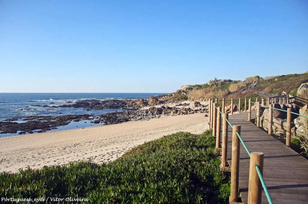
Stage 2: Labruge – Póvoa de Varzim (14 km (8.7 mi))
Wooden walkways over the dunes through Vila Chã and Mindelo; you cross the Ave river to enter the historic centre of Vila do Conde, already next to Póvoa de Varzim.
Stage 3: Póvoa de Varzim – Marinhas (24.5 km (15.2 mi))

Stage 3: Póvoa de Varzim – Marinhas (24.5 km (15.2 mi))
Seafront promenades and walkways beside the beaches of A Ver-o-Mar, Aguçadoura and Apúlia, and the bridge over the Cávado at Fão, opposite Esposende.
Stage 4: Marinhas – Viana do Castelo (20.8 km (12.9 mi))

Stage 4: Marinhas – Viana do Castelo (20.8 km (12.9 mi))
An inland stage, with no beaches: you cross the Neiva river on stone slabs and reach the historic centre of Viana do Castelo.
Stage 5: Viana do Castelo – Caminha (26.8 km (16.7 mi))

Stage 5: Viana do Castelo – Caminha (26.8 km (16.7 mi))
The official route goes inland (Areosa, Carreço, Afife) to Vila Praia de Âncora; from there, with no significant climbs, through Moledo to Caminha, at the mouth of the Minho.
Stage 6: Caminha – Porto Mougás (23.5 km (14.6 mi))

Stage 6: Caminha – Porto Mougás (23.5 km (14.6 mi))
You cross the Minho by boat to A Pasaxe, in A Guarda, and the Galician coast begins: wind-exposed viewpoints and the Cistercian monastery of Santa María de Oia beside the sea.
Stage 7: Porto Mougás – A Ramallosa (16 km (9.9 mi))

Stage 7: Porto Mougás – A Ramallosa (16 km (9.9 mi))
A hill section with views of the Cabo Silleiro lighthouse, passing through Baiona before reaching A Ramallosa, next to Sabarís.
Stage 8: A Ramallosa – Vigo (21.5 km (13.4 mi))

Stage 8: A Ramallosa – Vigo (21.5 km (13.4 mi))
The official route goes inland, with a lot of tarmac, through Nigrán and Coruxo; the riverside path along the Lagares river and the Castrelos park lead to Vigo.
Stage 9: Vigo – Redondela (15.4 km (9.6 mi))

Stage 9: Vigo – Redondela (15.4 km (9.6 mi))
From Vigo you climb to the Senda da Traída das Augas, an almost flat track with views of the estuary, and descend through Cedeira to Redondela, where the Coastal Route joins the Central Route.
Stage 10: Redondela – Pontevedra (19.8 km (12.3 mi))

Stage 10: Redondela – Pontevedra (19.8 km (12.3 mi))
From Redondela you climb to the Alto da Lomba, with views of the Vigo estuary, and descend to Arcade, oyster country. The Camino crosses the Verdugo by the medieval bridge of Ponte Sampaio and follows the Canicouva Roman road to Pontevedra and its Peregrina sanctuary.
Stage 11: Pontevedra – Caldas de Reis (21.1 km (13.1 mi))

Stage 11: Pontevedra – Caldas de Reis (21.1 km (13.1 mi))
You leave Pontevedra over the Ponte do Burgo across the Lérez, and the Camino gains stretches of forest and hamlets: the waterfalls of the Barosa river are 400 m from the route and the cruceiro of Tivo announces the arrival at Caldas de Reis, the spa town of the Romans.
Stage 12: Caldas de Reis – Padrón (18.6 km (11.6 mi))

Stage 12: Caldas de Reis – Padrón (18.6 km (11.6 mi))
One of the most pleasant sections of the Camino, through forests and hamlets after Caldas de Reis. You cross the Ulla at Pontecesures and enter Padrón, where tradition says the boat carrying the Apostle’s remains landed.
Stage 13: Padrón – Santiago de Compostela (24.4 km (15.2 mi))

Stage 13: Padrón – Santiago de Compostela (24.4 km (15.2 mi))
The last day: the collegiate church of Iria Flavia, the sanctuary of A Escravitude, O Milladoiro and the entry into Santiago de Compostela over the Ponte Vella of the Sar to the Obradoiro square.
How many days does the Portuguese Camino Coastal Route take?
Walking the Coastal Route from Porto takes 13 days (270.9 km (168.3 mi)), plus one or two rest days. Most pilgrims start closer to Santiago: these are the usual starting points, with their stages and distances.
- Coastal Route from Porto — 13 stages / 270.9 km (13 days): the whole Coastal Route, beside the Atlantic on boardwalks and seafront promenades.
- Portuguese Camino from Viana do Castelo — 9 stages / 187.1 km (9 days): a long week on the coast, with the boat across the Minho between Caminha and A Guarda.
- Portuguese Camino from A Guarda — 8 stages / 156 km (8 days): the Coastal Route through Galicia, from Caminha and the Minho boat or starting in A Guarda.
- Portuguese Camino from Baiona — 6 stages / 125.3 km (6 days): just over 100 km, with room to spare for the Compostela and one coastal stage before Vigo.
- Camino from Vigo — 5 stages / 99.3 km (5 days): right on the 100 km limit, along the Traída das Augas path above the estuary.
What the Coastal Route is like
Portugal: boardwalks, beaches and fishing villages
The first five stages are in Portugal. There are many kilometres of wooden boardwalk over the dunes and seafront promenade, but it is not all coast: between Marinhas and Viana do Castelo, and for much of Viana do Castelo – Caminha, the official route runs inland. It is a flat section, with more wind and less shade than the Central Route.
Crossing the Minho between Caminha and A Guarda
There is no bridge: you cross in a taxi boat from the jetty at Caminha to A Pasaxe, in A Guarda. In 2026 it costs €9 per person (€1 for a bicycle), the crossing takes about 10 minutes and the service runs from April to October from 7:00 to 15:30 (Portuguese time) and from November to March only from 8:00 to 9:00. Confirm the timetable before leaving Caminha.
Galicia: Oia, Baiona, Vigo and the estuary
Now in Galicia, the route passes the monastery of Santa María de Oia, climbs the hill opposite the Cabo Silleiro lighthouse and enters Baiona. Then comes Vigo and the Senda da Traída das Augas, with views over the estuary, as far as Redondela, where the Coastal Route joins the Central Route.
Coastal or Central Route?
From Porto, the Coastal Route is somewhat longer (about 271 km compared with about 241) and flatter, with more sea scenery, more wind and less shade. The Central Route runs inland, among vineyards, and passes through Barcelos and Ponte de Lima, with the Labruja climb. Both finish the same way: from Redondela to Santiago via Pontevedra, Caldas de Reis and Padrón.
Getting there and back
The Coastal Route starts in Porto: from Francisco Sá Carneiro airport (OPO), metro line E (violet) takes about half an hour to the city centre (Trindade), close to the cathedral. Many pilgrims save the city section by taking the metro towards Matosinhos and joining the coast there.
To get home, buses run several times a day from Santiago de Compostela to Porto and Porto airport (about 3.5 to 4 hours), and Santiago airport (SCQ) has direct flights to a number of European cities. Check current timetables before you travel.
Frequently asked questions
How many kilometres is the Portuguese Camino Coastal Route?
About 271 km from Porto to Santiago, adding up the usual stages: 187 km from Porto to Redondela and 84 km from Redondela to Santiago.
How many stages does the Coastal Route have?
13 stages: 9 from Porto to Redondela and 4 shared with the Central Route from Redondela to Santiago.
How do you cross the Minho on the Coastal Route?
In a taxi boat from Caminha to A Pasaxe (A Guarda). In 2026 it costs €9 and runs from April to October from 7:00 to 15:30, Portuguese time; in winter only from 8:00 to 9:00.
Can you get the Compostela by starting in Vigo?
Vigo is right on the 100 km limit: adding up the usual stages gives 99.3 km and adding up the Xunta’s (the Galician government) stages, 101.4. To be safe, start at A Ramallosa or Baiona.