Portuguese Camino Central Route: stages, distances and where to start
The Portuguese Camino Central Route is the historic route of the Portuguese Camino: it leaves Lisbon, climbs through the interior of the country via Santarém, Tomar, Coimbra, Porto, Barcelos and Ponte de Lima, crosses the Minho between Valença and Tui and continues through Galicia to Santiago de Compostela. Adding up the usual stages it comes to about 608 km (377.6 miles), which this guide splits into 26 stages.
You can start anywhere. The most common starting points are Porto, about 241 km (149.7 miles) from Santiago, and Tui, the first Galician town, from where a little more than the 100 km required for the Compostela remain: you will find it explained stage by stage in the Camino de Santiago from Tui. If you prefer to walk beside the sea, the Portuguese Camino Coastal Route also leaves from Porto and joins this route at Redondela.
The 26 stages of the Portuguese Camino Central Route, from Lisbon to Santiago de Compostela
Stage 1: Lisbon – Vila Franca de Xira (34.2 km (21.3 mi))

Stage 1: Lisbon – Vila Franca de Xira (34.2 km (21.3 mi))
The yellow arrows start at Lisbon Cathedral (Sé) and cross the Alfama. Then comes a long stretch beside the Tagus on wooden walkways, with the Vasco da Gama bridge in view, passing through Sacavém, Póvoa de Santa Iria and Alhandra.
Stage 2: Vila Franca de Xira – Azambuja (20 km (12.4 mi))

Stage 2: Vila Franca de Xira – Azambuja (20 km (12.4 mi))
A flat stage, almost all on tarmac, through Carregado and Vila Nova da Rainha. The last stretch follows a path parallel to the railway, opened to avoid a dangerous road.
Stage 3: Azambuja – Santarém (33 km (20.5 mi))

Stage 3: Azambuja – Santarém (33 km (20.5 mi))
The first half crosses the Tagus floodplain (Reguengo, Valada, Porto de Muge). The last 16 km have no villages and no shade, and end with the climb up to Santarém.
Stage 4: Santarém – Golegã (30.7 km (19.1 mi))

Stage 4: Santarém – Golegã (30.7 km (19.1 mi))
Flat terrain between vineyards and maize fields, through Vale de Figueira, Pombalinho and Azinhaga. The last 7 km go along a road with almost no hard shoulder to Golegã, the town of the Lusitano horse.
Stage 5: Golegã – Tomar (30.3 km (18.8 mi))

Stage 5: Golegã – Tomar (30.3 km (18.8 mi))
Dirt tracks and eucalyptus groves with stretches of tarmac, through Entroncamento, Vila Nova da Barquinha and Asseiceira, to Tomar, with its castle and the Convent of Christ.
Stage 6: Tomar – Alvaiázere (31.7 km (19.7 mi))

Stage 6: Tomar – Alvaiázere (31.7 km (19.7 mi))
You set off beside the Nabão river and then comes a constant up and down among oaks, olive trees and pines, with quite a lot of tarmac.
Stage 7: Alvaiázere – Alvorge (22.7 km (14.1 mi))

Stage 7: Alvaiázere – Alvorge (22.7 km (14.1 mi))
Stony paths among holm oaks and olive trees, alternating with tarmac, through Ansião, to the small whitewashed village of Alvorge.
Stage 8: Alvorge – Cernache (26.1 km (16.2 mi))

Stage 8: Alvorge – Cernache (26.1 km (16.2 mi))
A Roman stage: remains at Rabaçal and the ruins of the city of Conímbriga, before Condeixa-a-Nova. Most of it is on unsurfaced tracks.
Stage 9: Cernache – Coimbra (11.3 km (7 mi))

Stage 9: Cernache – Coimbra (11.3 km (7 mi))
A short stage so you reach Coimbra early: the first capital of Portugal and home to one of the oldest universities in Europe.
Stage 10: Coimbra – Sernadelo (24.8 km (15.4 mi))

Stage 10: Coimbra – Sernadelo (24.8 km (15.4 mi))
Sandy tracks among pines and eucalyptus to Mealhada, where the leitão (roast suckling pig) restaurants line the road one after another.
Stage 11: Sernadelo – Águeda (23.5 km (14.6 mi))

Stage 11: Sernadelo – Águeda (23.5 km (14.6 mi))
Lots of tarmac, industrial estates and verges with traffic, through Anadia, to Águeda, known for the street art in its streets.
Stage 12: Águeda – Albergaria-a-Velha (15.8 km (9.8 mi))

Stage 12: Águeda – Albergaria-a-Velha (15.8 km (9.8 mi))
A short stage through the Vouga region, with Mourisca do Vouga and Lamas do Vouga as villages on the way.
Stage 13: Albergaria-a-Velha – São João da Madeira (28.8 km (17.9 mi))

Stage 13: Albergaria-a-Velha – São João da Madeira (28.8 km (17.9 mi))
You pass through the historic centre of Bemposta and through Oliveira de Azeméis; the landscape becomes urban and industrial as you approach São João da Madeira.
Stage 14: São João da Madeira – Grijó (19 km (11.8 mi))

Stage 14: São João da Madeira – Grijó (19 km (11.8 mi))
A transition stage through Arrifana, Malaposta, Lourosa and Mozelos, already in the Porto area.
Stage 15: Grijó – Porto (15.1 km (9.4 mi))

Stage 15: Grijó – Porto (15.1 km (9.4 mi))
A stretch of Roman road through the forest and, after Vila Nova de Gaia, the entry into Porto over the Luís I bridge across the Douro.
Stage 16: Porto – Vilarinho (26.5 km (16.5 mi))
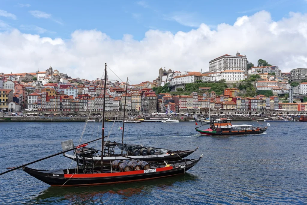
Stage 16: Porto – Vilarinho (26.5 km (16.5 mi))
Almost all tarmac to leave Porto’s urban area, past the airport and an industrial estate, through Senhora da Hora and Moreira da Maia. It is well waymarked.
Stage 17: Vilarinho – Barcelos (28.1 km (17.5 mi))

Stage 17: Vilarinho – Barcelos (28.1 km (17.5 mi))
Farmland and dirt tracks, passing São Pedro de Rates, to Barcelos, the city of the rooster.
Stage 18: Barcelos – Ponte de Lima (34.5 km (21.4 mi))

Stage 18: Barcelos – Ponte de Lima (34.5 km (21.4 mi))
A long stage through wine country, with the climb to Portela de Tamel (about 130 m over 2.3 km), to Ponte de Lima, beside the Lima river.
Stage 19: Ponte de Lima – Rubiães (17.4 km (10.8 mi))

Stage 19: Ponte de Lima – Rubiães (17.4 km (10.8 mi))
The big climb of the Portuguese Camino: the Portela Grande de Labruja pass, about 315 m over 4.2 km through forest. There are no services between Codeçal and Rubiães.
Stage 20: Rubiães – Tui (19.1 km (11.9 mi))

Stage 20: Rubiães – Tui (19.1 km (11.9 mi))
A descent through São Bento da Porta Aberta and Fontoura to Valença, its fortress and the international bridge of 1886 over the Minho (Miño), with a footbridge for pedestrians. On the other side, Tui and its cathedral.
Stage 21: Tui – O Porriño (16.1 km (10 mi))

Stage 21: Tui – O Porriño (16.1 km (10 mi))
The first Galician stage: you leave Tui beside the cathedral, follow the Louro valley and, at As Gándaras, choose between the industrial estate or the alternative beside the river to O Porriño.
Stage 22: O Porriño – Redondela (15.8 km (9.8 mi))

Stage 22: O Porriño – Redondela (15.8 km (9.8 mi))
Through Mos and its pazo you climb to the chapel of Santiaguiño, with a Roman milestone of Via XIX, and descend to Redondela, the town of the viaducts.
Stage 23: Redondela – Pontevedra (19.8 km (12.3 mi))

Stage 23: Redondela – Pontevedra (19.8 km (12.3 mi))
From Redondela you climb to the Alto da Lomba, with views of the Vigo estuary, and descend to Arcade, oyster country. The Camino crosses the Verdugo by the medieval bridge of Ponte Sampaio and follows the Canicouva Roman road to Pontevedra and its Peregrina sanctuary.
Stage 24: Pontevedra – Caldas de Reis (21.1 km (13.1 mi))

Stage 24: Pontevedra – Caldas de Reis (21.1 km (13.1 mi))
You leave Pontevedra over the Ponte do Burgo across the Lérez, and the Camino gains stretches of forest and hamlets: the waterfalls of the Barosa river are 400 m from the route and the cruceiro of Tivo announces the arrival at Caldas de Reis, the spa town of the Romans.
Stage 25: Caldas de Reis – Padrón (18.6 km (11.6 mi))

Stage 25: Caldas de Reis – Padrón (18.6 km (11.6 mi))
One of the most pleasant sections of the Camino, through forests and hamlets after Caldas de Reis. You cross the Ulla at Pontecesures and enter Padrón, where tradition says the boat carrying the Apostle’s remains landed.
Stage 26: Padrón – Santiago de Compostela (24.4 km (15.2 mi))

Stage 26: Padrón – Santiago de Compostela (24.4 km (15.2 mi))
The last day: the collegiate church of Iria Flavia, the sanctuary of A Escravitude, O Milladoiro and the entry into Santiago de Compostela over the Ponte Vella of the Sar to the Obradoiro square.
How many days does the Portuguese Camino Central Route take?
Walking the Central Route from Lisbon takes 26 days (608.4 km (378 mi)), plus one or two rest days. Most pilgrims start closer to Santiago: these are the usual starting points, with their stages and distances.
- Central Route from Lisbon — 26 stages / 608.4 km (26 days): the whole Central Route: the Tagus, Tomar, Coimbra and Porto, with few pilgrim albergues before Coimbra.
- Portuguese Camino from Coimbra — 17 stages / 368.4 km (17 days): from the university city through the Bairrada and the Vouga valley to Porto, then the Minho.
- Portuguese Camino from Porto — 11 stages / 241.4 km (11 days): the most popular start on the Central Route, via Barcelos, Ponte de Lima and the Labruja climb.
- Portuguese Camino from Ponte de Lima — 8 stages / 152.3 km (8 days): the greenest stretch of the Minho and the highest point of the Portuguese Camino, in just over a week.
- Camino from Tui — 6 stages / 115.8 km (6 days): the last 100 km and the most popular start; Valença is just across the bridge.
The Central Route section by section
From Lisbon to Porto: the Portugal of the Tagus and Coimbra
It is 15 stages and about 367 km (227.9 miles). The first days follow the Tagus over flat, hot terrain, with stages of more than 30 km and long stretches without villages or shade. Then come Tomar, Conímbriga and Coimbra, and the landscape becomes more industrial as you approach Porto, which you enter over the Luís I bridge.
From Porto to Tui: vineyards, Ponte de Lima and the Labruja climb
Five stages and about 126 km (78.2 miles). After leaving the urban area of Porto, the Camino crosses the agricultural north via São Pedro de Rates, Barcelos and Ponte de Lima. The only serious climb on the whole route is the Portela Grande de Labruja, between Ponte de Lima and Rubiães. The fifth stage ends by crossing the Minho on the international bridge from Valença to Tui.
From Tui to Santiago: the last 100 km
Six stages and about 116 km (72.0 miles) through the province of Pontevedra and the south of A Coruña. The Coastal Route joins at Redondela, so the last four stages, from Redondela to Santiago, are shared by both routes: you will find them in the Camino de Santiago from Tui.
The Spiritual Variant
At Pontevedra the Spiritual Variant branches off, a three-stage alternative (about 79 km) that passes the monastery of A Armenteira and Vilanova de Arousa and reaches Padrón by sailing up the Arousa estuary and the River Ulla. At Padrón it rejoins the Central Route for the last stage to Santiago.
Where to stay on the Central Route
At the end of each stage from Tui to Santiago there is a table of the albergues (pilgrim hostels) in the arrival town: beds, price from, opening season and booking. You can also look them up town by town in the towns of the Portuguese Camino.
Getting there and back
For the Central Route, fly into Lisbon (LIS) to walk the whole route, or into Porto (OPO) to start in Porto. From Porto airport, metro line E (violet) reaches the city centre (Trindade) in about half an hour; the cathedral is a short walk away. Lisbon airport is on the metro red line, about 7 km (4 miles) from the centre.
To get home, buses run several times a day from Santiago de Compostela to Porto and Porto airport (about 3.5 to 4 hours), and Santiago airport (SCQ) has direct flights to a number of European cities. Check current timetables before you travel.
Frequently asked questions
How many kilometres is the Portuguese Camino Central Route?
About 608 km from Lisbon to Santiago, adding up the usual stages. From Porto it is about 241 km and from Tui about 116 km.
How many stages does the Portuguese Camino Central Route have?
26 stages from Lisbon to Santiago in this guide: 15 as far as Porto, 5 from Porto to Tui and 6 from Tui to Santiago. Some guides do Tui – Redondela in a single 31.9 km stage; here it is split at O Porriño.
Where does the Central Route meet the Coastal Route?
At Redondela. The four stages from Redondela to Santiago are shared by both routes.
Which is the hardest stage on the Central Route?
In terms of elevation, Ponte de Lima – Rubiães, with the climb to the Portela Grande de Labruja: about 315 m in 4.2 km. In terms of distance, the stages of more than 30 km between Lisbon and Tomar and Barcelos – Ponte de Lima (34.5 km).